WELCOME TO THE
Geospatial Council of Australia
Find your place. Join the Geospatial Council to grow your career or business and be recognised for your professional expertise

Policy & advocacy
Industry consultation
Workforce expertise
Coaching & certification
Professional Development
Events & CPD
Awards & recognition
Industry excellence
Who we are
The peak professional body for the geospatial sector
The Geospatial Council of Australia represents the interests of organisations and individuals, including new and emerging professionals, working in the vast range of occupations for surveying, space and spatial in the digital world.
Today’s geospatial professionals are leaders and innovators, advancing our industries with technologies using located based services, drones and autonomous vehicles, 3D modelling, robotics, artificial intelligence, machine learning, virtual reality and the Internet of Things.
Build your profile and professional expertise through our areas of practice, special interest groups and more.
Find your place. There’s a world of possibilities in the future of geospatial when you join the Geospatial Council.
LATEST NEWS
Member news
Geospatial Council of Australia launches National Engineering Surveying Certification v2.0
The Geospatial Council of Australia (GCA) is pleased to announce the launch of the National Engineering Surveying...
Advocacy
GCA Mentoring Program 2025 Call for volunteers
We are looking for two enthusiastic volunteers to join our GCA Mentoring Program Working Group! If you can commit to...
Events
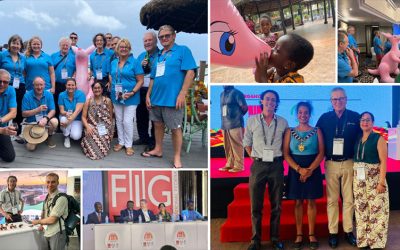
FIG Working Week 2024 Recap
From 19 – 24 May, more than 1,000 delegates from 90 countries converged in Accra, Ghana, for a highly memorable conference, FIG Working Week 2024
UPCOMING EVENTS
supporting partners and organisational members


")


The Geospatial Council of Australia recognises the unceded sovereign lands and rights of Aboriginal and Torres Strait Island peoples as the First Peoples of these lands and waters. First Nations culture and traditions are a rich source of knowledge and discovery. The Geospatial Council recognises a professional commitment to engage and act meaningfully through reciprocal partnership and relationships with Aboriginal and Torres Strait Islander peoples.